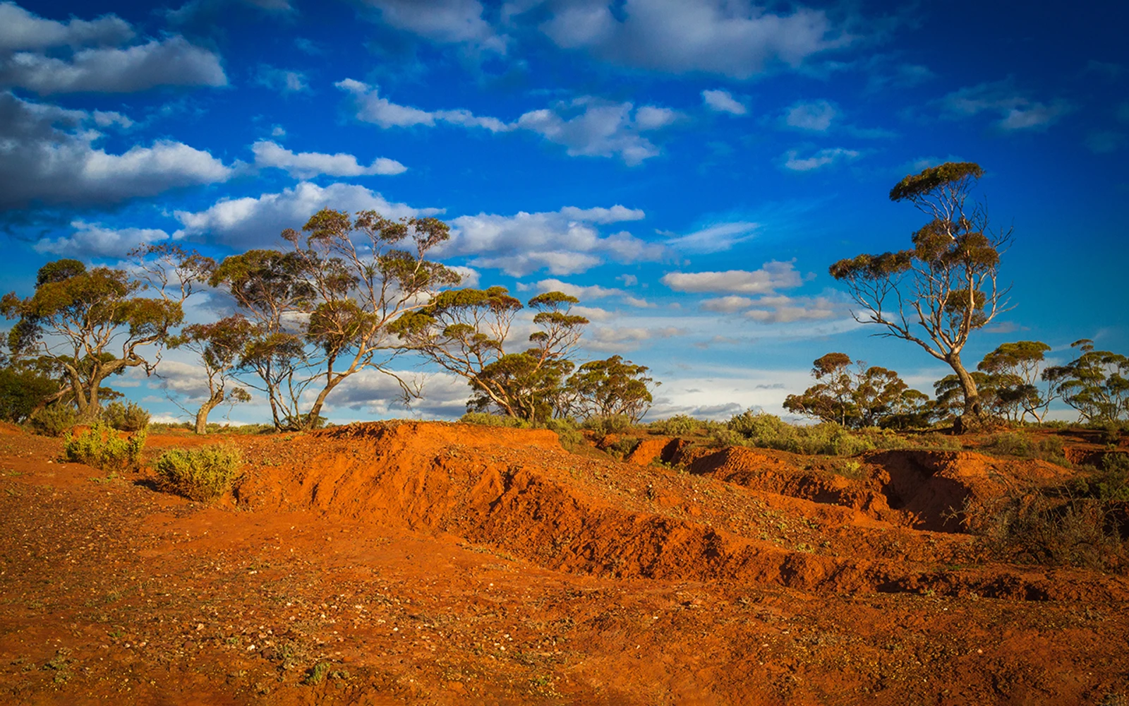
Completed 2024 Officer–Musgrave–Birrindudu
In alignment with the Exploring for the Future vision, the Officer-Musgrave-Birrindudu project developed an integrated geoscientific understanding of the resource potential of this frontier region. Project activities and outputs support regional communities, providing an evidence-base for future resource use, encouraging investment and job creation, and leading to improved economic, social and cultural outcomes. This project also developed, refined and implemented novel scientific workflows and methods that can be applied in other frontier regions across Australia.
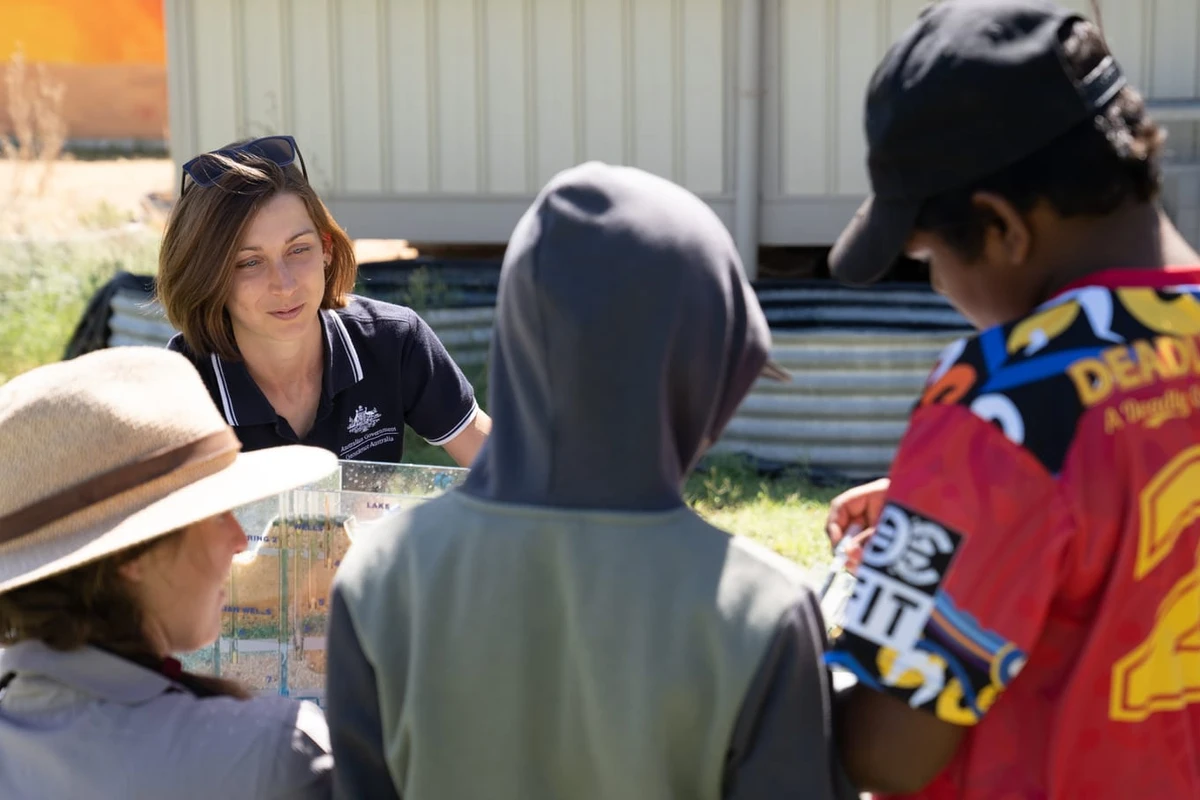
Groundwater investigations focused on the Musgrave Province, Officer Basin and far eastern Canning Basin to identify potential palaeovalley groundwater resources, vital to responsible future development and supporting local communities.
The energy component of this project included the acquisition of key new precompetitive data in the Officer and Birrindudu basins, and re-analysis of existing datasets covering the Officer Basin. This work improves understanding of regional resource potential, stimulating industry exploration investment in the medium-term and ultimately leading to new discoveries and economic benefits for the region.
Key activities included hydrogeological, geological, and geophysical data acquisition, developing basin and palaeovalley system understanding and resource potential assessments.
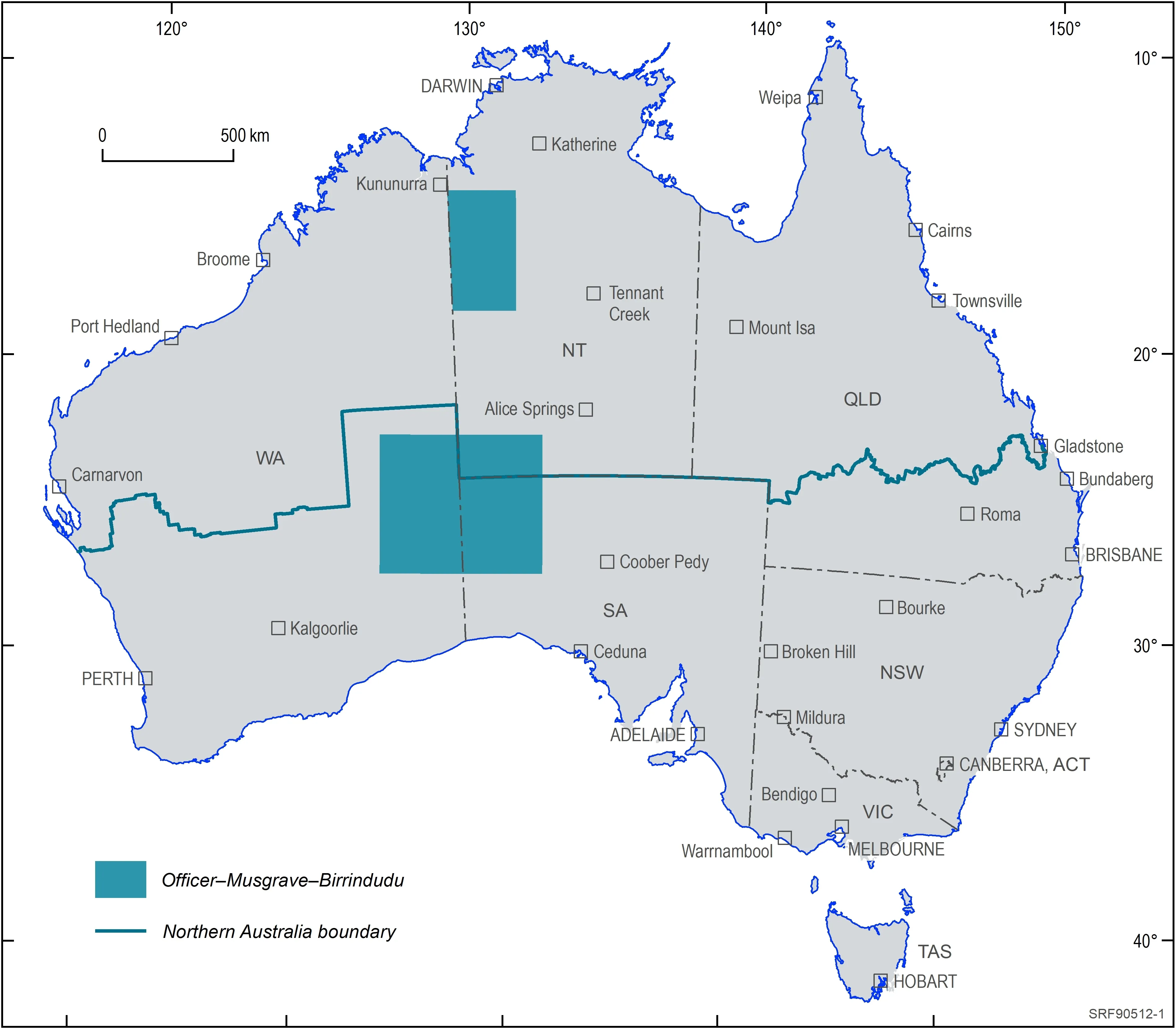
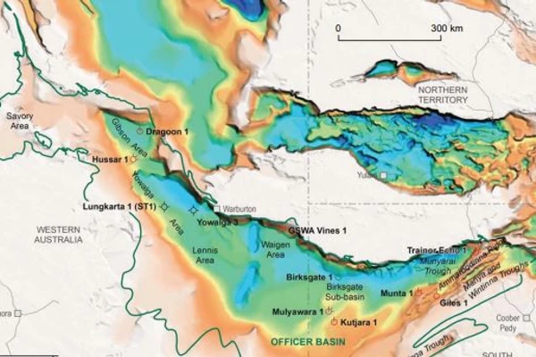
The Officer–Musgrave–Birrindudu project area
The project incorporated a number of study areas and activities, including:
In the Officer-Musgrave project region, groundwater is the only water supply for communities, pastoral use and industry. Palaeovalley groundwater systems are known to occur in the region and are a valuable resource. The Officer-Musgrave Palaeovalley study sought to map and model the distribution of palaeovalley systems using new airborne electromagnetic (AEM) data acquired across the region to develop and refine the hydrogeological conceptual models of these groundwater systems. This work also involved acquiring additional hydrogeophysical and hydrochemical data, and compiling and interpreting pre-existing geological, geophysical and hydrogeological data, to provide valuable information on water resources for remote communities, water managers and industry.
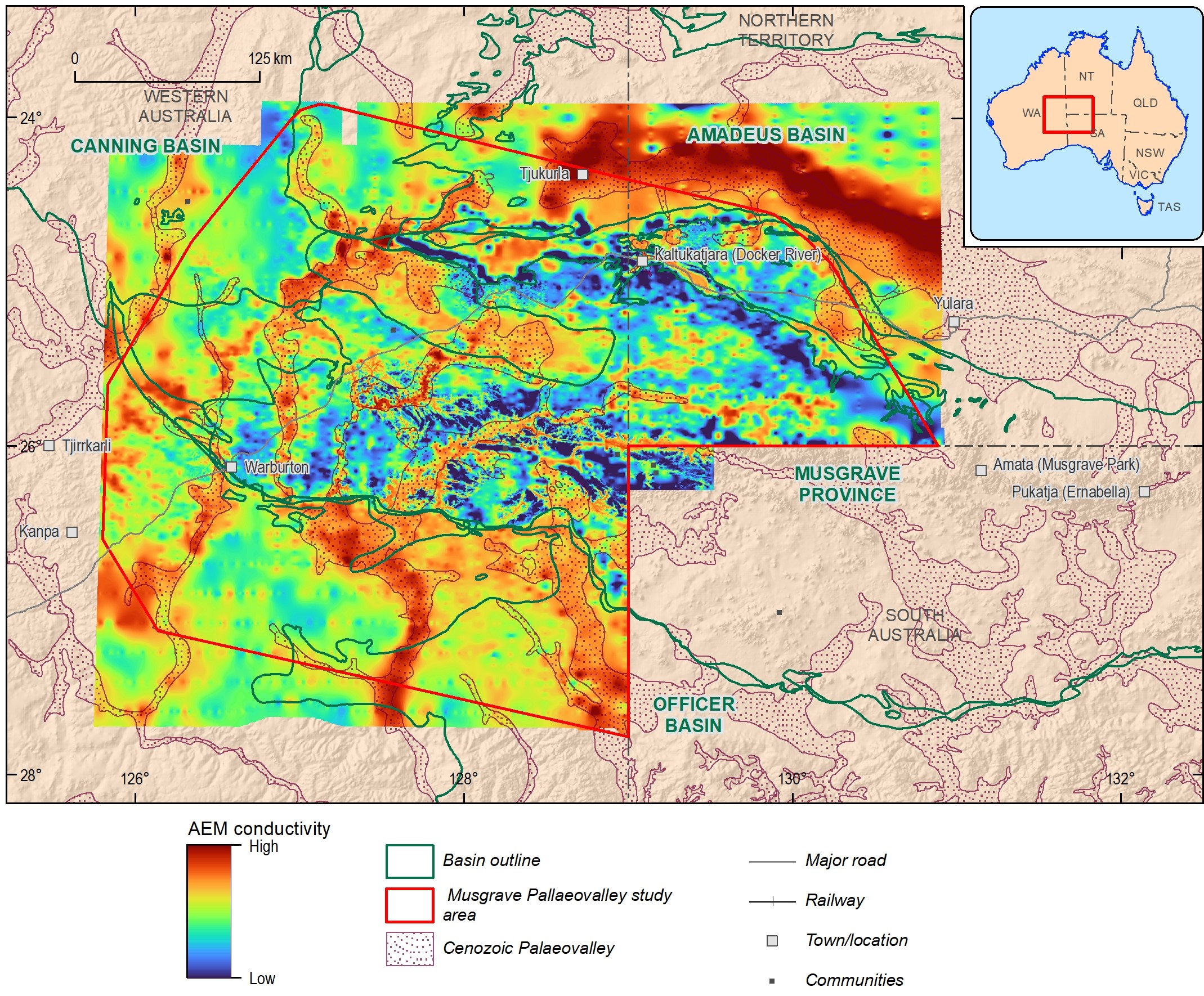
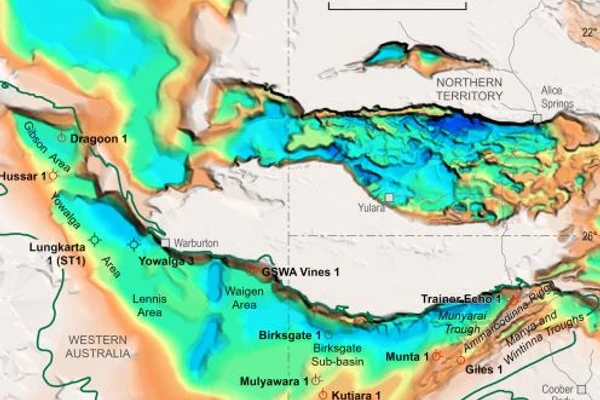
Map showing Musgrave Palaeovalley study area and AEM derived conductivity grids for approximately 34 metres below the ground. This grid used AEM data acquired as part of the Officer-Musgrave palaoevalley project and reprocessed AEM data acquired for minerals exploration
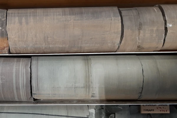
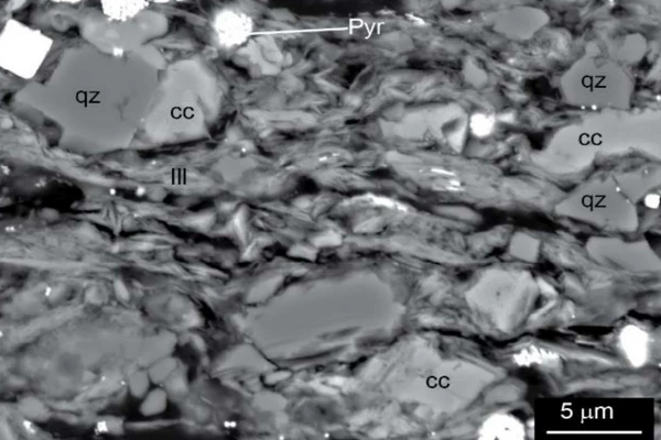
Little is known about the energy resource potential of the Officer Basin. Geoscience Australia is providing new data to improve the geological knowledge of the basin and its geological constraints. Stratigraphy and resource potential studies that analysed existing and newly acquired field samples were designed to systematically investigate energy potential.
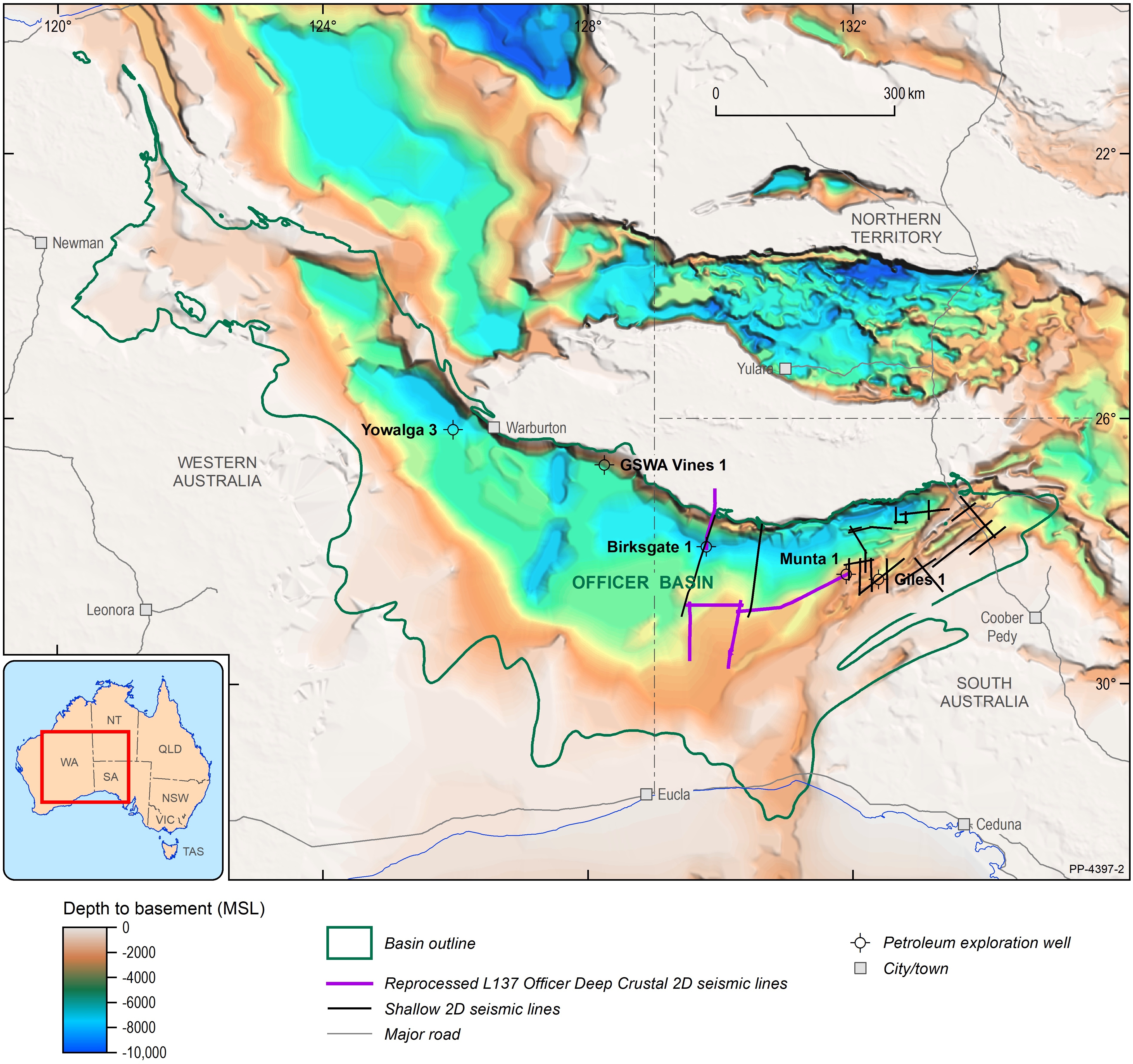
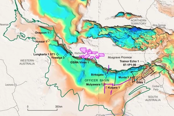
Map showing the Officer-Musgrave region across Western and South Australia (Raymond et al, 2009 and 2018)
The Birrindudu Basin is a frontier basin for energy resources. While it contains rocks of a similar age to those prospective for energy systems in McArthur Basin, South Nicholson region and Mount Isa Province to the east, it remains comparatively poorly understood in terms of energy resource potential.
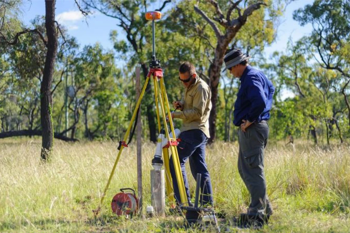
Geoscience Australia acquired a range of new datasets, including geophysical data and analysed selected existing drill holes, providing an improved understanding of the stratigraphy and resource potential of the Birrindudu Basin and surrounding region.
Acquisition included the ~900 km Northwest Northern Territory Seismic Survey (L214), co-funded by the Northern Territory Government, in the region between Timber Creek in the north and Tanami in the south.
The survey tripled seismic coverage over the Birrindudu Basin and adjacent regions, enabling this highly prospective region to be assessed for critical minerals and geoenergy potential as well as potential groundwater resources.
The raw seismic data for the Northwest Northern Territory Seismic Survey is now available from Geoscience Australia.
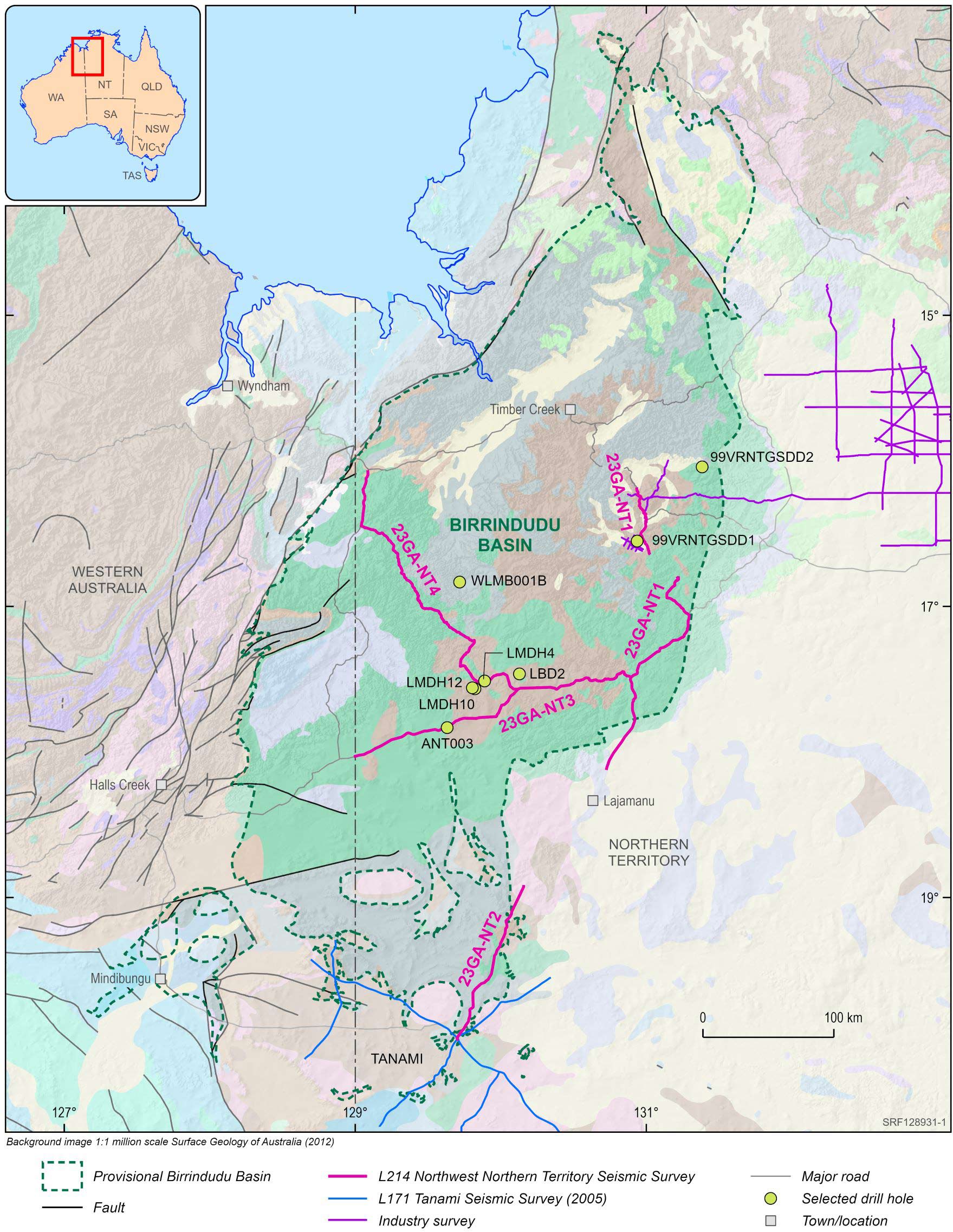
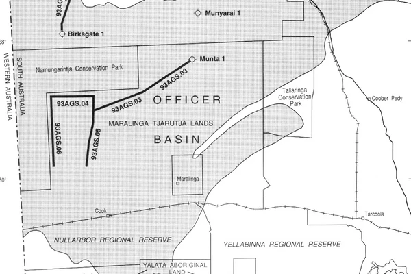
Provisional outline of the Birrindudu Basin, showing existing drill holes sampled for analysis and the Northwest Northern Territory Seismic Survey (L214). The seismic lines displayed represent the acquired seismic path. Some segments of the displayed lines were not acquired due to restrictions. No data is available in the upper crust under these restricted segments. However, the data in the mid and lower crust is available due to acquisition design and the signal spanning the restricted segments
Geoscience Australia acknowledges all landholders and communities who support our work in rural, regional and remote Australia.
Carr, L. K., Henson, P., Wang, L., Bailey, A., Fomin, T., Boreham, C., Edwards, D., Southby, C., Symington, N., Smith, M., Halas, L., Jones, T. (2022)
Edwards, D., Munday, S., Wang, L., Riley, D., Khider, K. (2022)
Bailey, A., Wang, L., Dewhurst, D., Anderson, J., Carr, L.K. and Henson, P. The APPEA Journal (May 2022)
Geoscience Australia is committed to land, air and marine access best practice and to protecting cultural heritage and the environment.
We thank the people and communities who collaborate with us to ensure the success of the Exploring for the Future program.
Geoscience Australia activities are not undertaken on behalf of any exploration company; we work for the benefit of all Australians.
All data produced by Geoscience Australia, including the data from this project, is publicly available after quality assurance has been performed.
For more information or general enquiries, please email clientservices@ga.gov.au
The Exploring for the Future program (2020–24) focused on 8 interrelated projects, united in growing our understanding of Australia's geology.
Deep-dive
Three deep-dive projects in potentially resource-rich corridors identified in the east and west of Australia: Darling–Curnamona–Delamerian, Officer–Musgrave–Birrindudu and Barkly–Isa–Georgetown projects.
National
Three national projects with a focus on southern Australia: Australia's Resources Framework, National Groundwater Systems and Australia's Future Energy Resources projects.
Program support
Two program support projects: Enhanced Data Delivery and Geoscience Knowledge Sharing projects.