Completed 2024 National Geochemical Framework
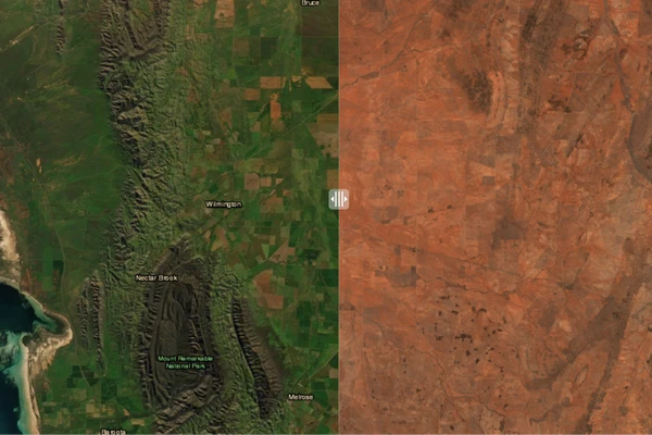
The surface of the Australian continent can provide valuable insights into the environmental, economic and agricultural landscape of the country, enabling informed decision-making for a range of industries. The National Geochemical Framework study primarily focuses on the rich archive of samples and data housed at Geoscience Australia. These samples are a precious resource. In some cases they were collected prior to any development in an area, meaning they can provide baseline geochemical information about the area that would not be possible if the sample were collected today.
Due to the diverse nature of the surface of Australia and the information that we can derive from it, the National Geochemical Framework study was split into the following activities:
Each of these activities focused on different ways of analysing and interpreting surface geochemical and mineralogical data.
The Levelled Geochemical Baselines activity built on a pilot study that was undertaken in the North Australian Craton, which focussed on levelling the existing data. This levelling was designed to remove the variation in the data introduced by the analytical laboratory. This analytical variability would normally introduce slight differences between samples analysed at different times leading to inconsistent statistics and edge effects on maps.
In this expanded project, archived samples from surveys spanning the last 50 years were re-analysed using modern, higher-precision instruments and analysing a wider range of chemical elements, to bring the assay data for these samples up to modern standards.
Following this re-analysis, the new data was levelled with existing modern surficial geochemical surveys (National Geochemical Survey of Australia, Northern Australia Geochemical Survey, Southern Thomson Region Geochemical Survey).
The combined datasets assist in refining geochemical grids of Australia, set environmental baselines and assist explorers to determine areas of interest.
This activity re-analysed archived samples to gain new insights into the distribution of heavy minerals and isotopes across Australia, as well as identifying new regions of interest. The work contributes to mineral prospectivity assessments.
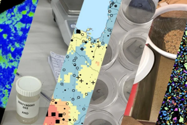
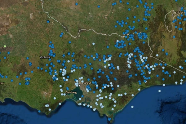
Using samples from the continental-scale National Geochemical Survey of Australia (NGSA), new data on mineralogy was collected to develop the Heavy Mineral Map of Australia. The Heavy Mineral Map of Australia is the world's first publicly available, continental-scale, heavy mineral dataset and atlas.
Heavy minerals are used extensively around the world for mineral or energy exploration, including in the search for critical minerals. Through a collaboration with Curtin University, 1,315 archived samples from across Australia were analysed for automated identification and quantification of heavy minerals. The analysis reveals information about the upland and shallowly covered bedrock, which is of particular importance in areas of cover, where traditional methods of exploration, such as geochemistry, can be ineffective.
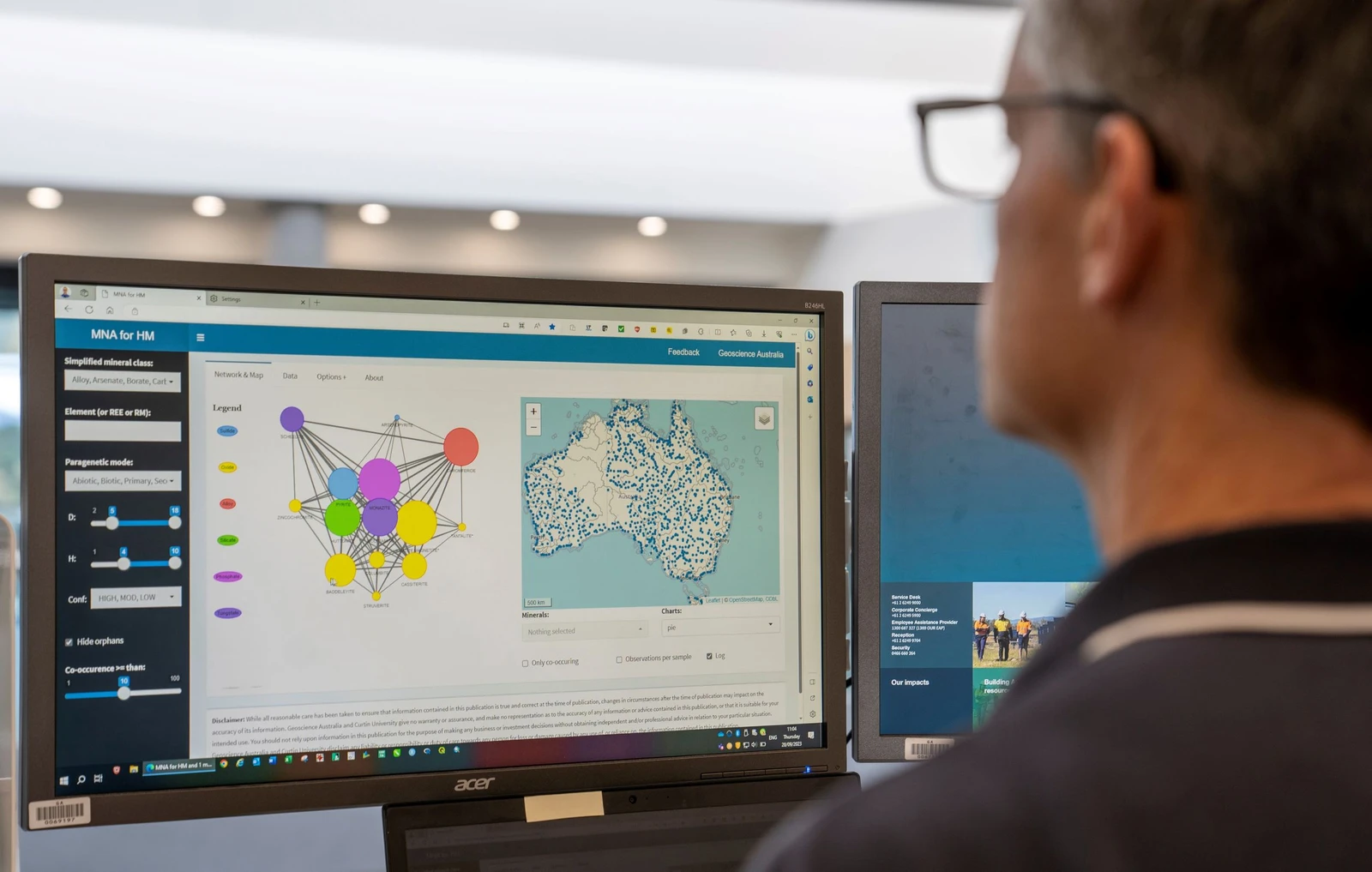
The Heavy Mineral Map of Australia and accompanying cloud-based mineral network analysis (MNA) toolpositively impact mineral exploration and prospectivity modelling around Australia, including for critical minerals, as well as having other applications in earth and environmental sciences.
Through collaboration with the University of Wollongong, archived NGSA samples from large parts of eastern and northern Australia were analysed for strontium isotopes. Isotopes are atoms of the same chemical element (in this case strontium) with different numbers of neutrons, giving the atom different mass and hence slightly different physical properties. Isotope ratios (proportions) can provide a 'fingerprint' of rock-types or geological processes. The strontium isotope system can shed light on the provenance of sediments, mixing with aeolian material, and can potentially identify lithologies and mineral system components under shallow cover. A combination of total and partial digestion strontium analyses provide essential data for constructing a map of strontium isotopes (an isoscape) that can assist in ecological and anthropological studies.
The Geochemical Grids of Australia activity created seamless, national-scale predictive surface geochemical maps of Australia. It applied machine learning algorithms in an automated workflow that relied on using a range of multi-disciplinary datasets (remote sensing, geophysics and geology), in combination with the wealth of curated rock and regolith geochemical data from Geoscience Australia and state/NT survey databases.
These machine learning-derived maps open new ways of viewing and interpreting geochemical data. By using national-scale covariates (input datasets) the resulting geochemical grids are national-scale, despite the continent not having complete coverage of geochemical data. This provides valuable predictions for areas of the country that lack data because they are remote or otherwise difficult to access.
Levelled Geochemical Baselines
Heavy Mineral Map of Australia
Strontium Isoscape of Australia

The Heavy Mineral Map of Australia (HMMA) is the world's first public domain, continental-scale heavy mineral dataset and atlas. Through a collaboration with Curtin University, over 1,000 archived samples from across Australia have been analysed for automated identification and quantification of heavy minerals. The HMMA and accompanying cloud-based mineral network analysis (MNA) tool will positively impact mineral exploration and prospectivity modelling around Australia, as well as have other applications in earth and environmental sciences. The HMMA and MNA tool was publicly released at a workshop on 12 October 2023 in Perth.
Ongoing collaboration between Geoscience Australia and a wide range of agencies and institutions is building a nationally valuable database of geochronology and isotopes.
Researchers from Geoscience Australia and the Australian National University have recently released a new national Barest Earth product that uses the Digital Earth Australia satellite archive.