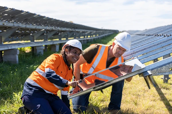
2016–20 What have we achieved so far?

The integration of datasets collected via a variety of techniques across such a large area represents a world-first in geoscience programs. Geoscience Australia has utilised considerable scientific skills and technical capabilities in geology, hydrogeology, geophysics, geochemistry, analysis and information technology, and transformed data into useful formats to provide a holistic picture of Australia's minerals, energy, and groundwater resources.
The first 4 years of the program has given us a world-first picture of our geology and hydrogeology of northern Australia. We have enhanced our understanding of mineral, energy and groundwater resources, and challenged how we look for them, and dramatically improved our techniques for capturing and analysing data. We have strengthened our collaborative partnerships with states, the Northern Territory, and domestic and international research partners, giving us a strong foundation to take forward future geoscience projects.
The information gathered throughout the program has been crucial in the development of the innovative online Data Discovery Portal. The portal not only demonstrates our capability as a world leader in implementing science and innovation behind resource exploration, it also gives stakeholders the information they need to assess the mineral, energy and groundwater potential ultimately benefiting the community, regions and all Australians through investment and development. We are effectively placing data directly into the hands of the people and providing explorers, investors and planners with evidence to support their decisions, making a real difference to Australian communities.
Groundwater research in northern Australia has traditionally relied on bores that date back to the 1950s and 60s. The information gathered from these bores has been used by scientists for decades to find potential aquifers.
Using data and research from the existing bores along with new groundwater samples and extensive airborne surveys we now have a more sophisticated understanding of how the groundwater flows and recharges across northern Australia. This has allowed us to identify potential new groundwater resources, assess groundwater storage options and provide baseline data to inform decisions on water management plans and environmental impact assessments.
The work shows the potential to challenge our current understanding, even in well-understood areas. By combining a range of datasets and new research, new information about critical water systems can be revealed. Across the region, the integration of new and historical data has created essential information for communities, water agencies and resource companies as they plan drinking water for towns, water allocations for agriculture, and inform investment and development decisions of the mineral and energy resources.
The evidence from the program will continue to build our understanding of northern Australia's groundwater resources for decades to come.
A map showing locations where groundwater-related research projects were carried out, and new groundwater data collected, during 2016-20 of the Exploring for the Future program
In the previously underexplored remote regions of the South Nicholson Basin, in the Northern Territory and Queensland, and the Canning Basin in Western Australia, we conducted large-scale seismic surveys over 2,784 km. Using equipment to measure how vibrations travel through the Earth's crust, we were able to create a picture of the rock layers 50 km or more beneath the surface.
The results have been extremely important in understanding these regions and their potential for resource exploration. We have successfully:
The data gathered from this project has sparked significant investment from resources companies in the regions, including up to $95 million in investment from Santos Limited in the region of the newly-identified Carrara Sub-basin. The long-term impact of the discoveries will undoubtedly drive even greater development and economic opportunities in these regions.
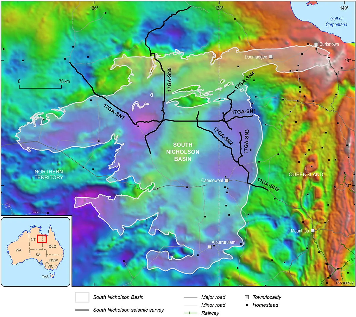
A gravity map showing the location of the South Nicholson Basin (white outline). The black lines represent seismic surveys completed in this region as part of the Exploring for the Future program, providing new data across the Northern Territory and Queensland border
The combination of innovative techniques has proven highly successful in the search for minerals. Industry has responded well by adopting a number of the new techniques and tools discovered through the program.
We have used a wide range of scientific techniques at unprecedented scale and incorporated new and existing data from thousands of individual passive seismic, gravity and magnetotelluric stations to 'look into' the Earth deep beneath northern Australia. Each technique and activity alone can give us a wealth of information. Integrated together, these datasets provide powerful tools for predicting where resources may lie. They enable us to produce reliable, detailed data to encourage further exploration.
Key findings have included the discovery that 85% of global sediment hosted base metals (like copper, lead, and zinc) can be found along the edges of thick portions of tectonic plates. We have also identified highly conductive zones underlying the East Tennant region, potentially indicating areas where hot fluids travelled to the Earth's surface, bringing minerals with them.
Tom Wesby, Generative Geologist at First Quantum Minerals Ltd, said of these discoveries, 'It's useful for our terrane ranking, because it provides a good quality check on assumptions we had previously made about the likely foci of crustal deformation and longevity of crustal blocks.'
The wealth of new data collected during the program, augmented by existing in-house data and samples, has enabled us to build a range of powerful and innovative online tools. Through these tools we can put data into the hands of those who need it, whether to assess mineral or energy potential, groundwater, cover thickness, or the economic viability of potential exploration projects. These tools can be accessed via the Exploring for the Future Data Discovery Portal.
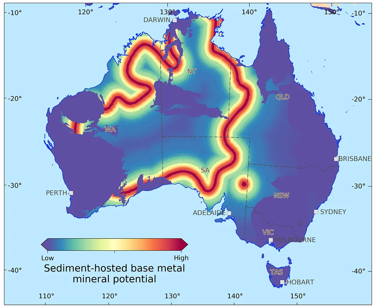
A heat map showing areas with a high potential for holding sediment-hosted copper, zinc and lead deposits. This map is based on the discovery that all giant deposits of this type, in Australia and the world, are found above the edges of thick portions of tectonic plates

Exploring for the Future is a world leading program, delivering public geoscientific data and the evidence required to attract future investment in resource exploration and development.
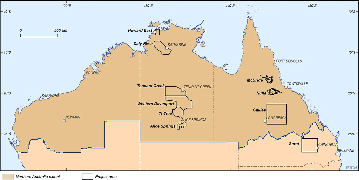
We have completed 21 collaborative activities that have mapped the geology of northern Australia, covering over 3 million km2 — 39% of Australia's landmass and delivering more than 250 datasets and reports.

Unlocking Australia's mineral, energy, and groundwater resource potential is essential to drive economic growth, job creation, and ongoing infrastructure and community development.
According to a 2023 Deloitte Access Economics report, government geoscience data and analysis supported $76b of added value to the economy in 2021-22, or 3.5% of GDP. Learn more about how the program has realised impact
Better evidence-based decision-making between landholders, traditional owners, public, government and industry.
Growing economic prosperity and social well-being through resource development, investment in resource exploration, new job creation and responsible agricultural planning.

Improved intergenerational water security and community resilience.