The Australian Passive Seismic Array Project (AusArray) is a collaborative, national survey between government and academia that acquires passive seismic data.
The project started in 2016 through the Exploring for the Future program and continues through the support of the state and territory geological surveys and academia.
AusArray focuses on the creation of an updatable 3D model of the sub-surface seismic velocity variations. This model constrains local and regional Earth structures useful for the assessment of resource potential and natural hazards.
From 2016 to 2020, the Exploring for the Future program supported deployment of an array of broadband seismic instruments at more than 200 sites across the Northern Territory and Queensland on a half degree or ~55 km spaced grid.
From 2021 to 2024 the broadband seismic instruments were arranged in a grid pattern spaced 2-degrees or ~220 km apart across the entire continent, complemented by 12 semi-permanent higher sensitivity broadband seismic instruments. These instruments measure small natural vibrations that travel through the Earth caused by local and distant earthquakes, waves breaking on the shore and even wind.
These data help scientists to understand the variation in seismic velocity across the continent and, based on that, the composition of rocks beneath the surface. Results from the 2016-2020 deployment revealed new subsurface features that helped explain the geological evolution of northern Australia. It revealed a new sedimentary basin and provided explorers with insights into the potential for discovering new mineral and energy resources. Data from the half degree or ~55 km spaced AusArray deployments also allowed for better characterisation of Australian earthquakes, which is improving our natural hazard modelling and making our communities safer.
- Watch an animation on How passive seismic surveys work (1:56 min)
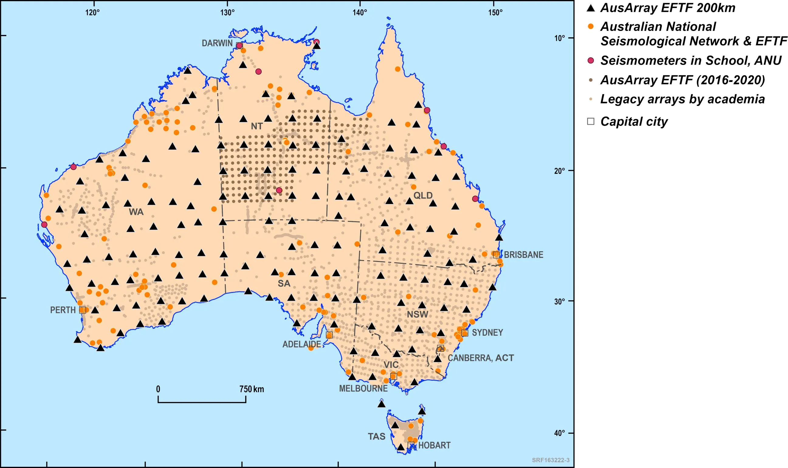
Location of AusArray seismic stations (as at June 2024)
Key activities and outcomes from 2020 to June 2024 included:
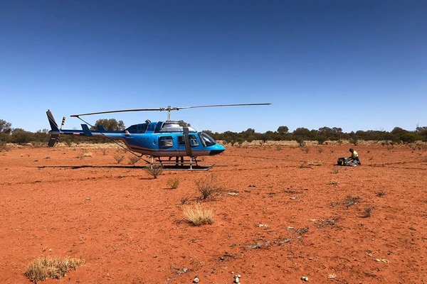
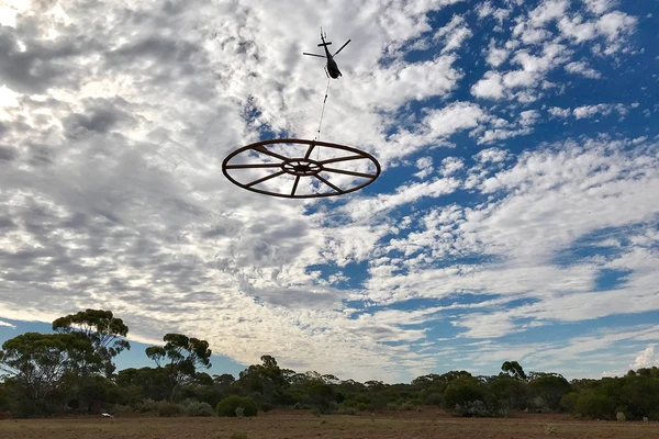
- Deployment of broadband seismic instruments at 2-degree or ~220 km spacing across most of Australia (see the map). These instruments were left in the ground for at least one year or more in order to collect sufficient data.
- Processing of data collected between 2016 and 2020 across parts of the Northern Territory and Queensland. These data identified and refined the mapping of key geological features in the sub-surface, including the presence of sedimentary basins.
- Processing of all legacy data collected by government and academia. These data enabled the building of preliminary models over the entire Australian continent.
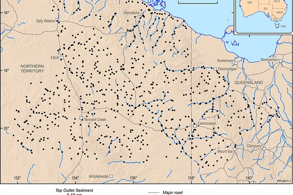
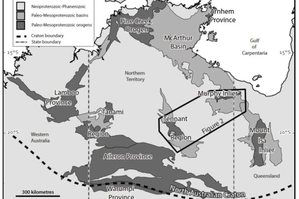
Key activities and outcomes in the northern Australia region between Tennant Creek and Mount Isa from 2016 to 2020 included:
- 2 deployments of a constellation of 130 broadband seismic instruments in a grid pattern in 2 adjoining areas, with each deployment lasting for one year
- improved national 3D seismic velocity models of the Australian plate focused on northern Australia
- higher resolution 3D seismic models in areas covered by the transportable array from which physical properties of the lithosphere can be inferred from depths of a few metres to hundreds of kilometres.
The models can be accessed via the Exploring for the Future Data Discovery Portal.
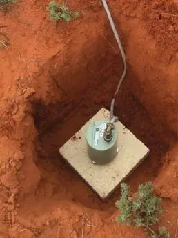
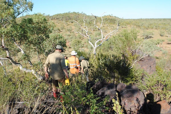
An image of an uncovered broadband seismic instrument in Queensland
Outputs
Data and publications
- Australian National Passive Seismic Data Collection. 2022. Geoscience Australia, Canberra
- Receiver Function volumetric model of north-eastern Northern Territory and north-western Queensland. Gorbatov, A. 2023. Geoscience Australia, Canberra
- AusArray: quality passive seismic data to underpin updatable national velocity models of the lithosphere. Gorbatov, A., Czarnota, K, Hejrani, B., Haynes, M.W., Hassan, R., Medlin, A., Zhao, J., Zhang, F., Salmon, M., Tkalcic, H., Yuan, H., Dentith, M., Rawlinson, N., Reading, A.M., Kennett, B.L.N., Bugden, C. 2020. Geoscience Australia, Canberra
- Passive seismic lithospheric imaging - implications for mineral potential assessment. Gorbatov, A., Hejrani, B. 2024. Geoscience Australia, Canberra
- Moho variations in northern Australia. Geoscience Australia. Gorbatov, A., Medlin, A., Kennett, B.L.N., Doublier, M.P., Czarnota, K, Fomin, T., Henson, P. 2020. Canberra
- AusArray TROMINO active seismic data acquisition, processing and MASW modelling. GA record 2022/027. Holzschuh, J. 2023. Geoscience Australia, Canberra
- High-Performance Seismological Tools (HiPerSeis). Hassan, R., Hejrani, B., Medlin, A., Gorbatov, A., Zhang, F. 2020. Geoscience Australia, Canberra
- Developing thermochemical models of Australia's lithosphere. Haynes, M.W., Fomin, I., Afonso, J. C., Gorbatov, A., Salajegheh, F. 2020. Geoscience Australia, Canberra
- AusArray: Imaging the lithospheric mantle using body-wave tomography. Haynes, M.W., Gorbatov, A., Hejrani, B., Hassan, R., Zhao, J., Zhang, F., Reading, A.M. 2020. Geoscience Australia, Canberra
- Ambient noise tomography of Australia: Application to AusArray deployment - Update. Hejrani, B. 2023. Geoscience Australia, Canberra
- Ambient noise tomography of Australia: application to AusArray deployment. Hejrani, B., Hassan, R., Gorbatov, A., Sambridge, M., Hawkins, R., Valentine, A., Czarnota, K., Zhao, J. 2020. Geoscience Australia, Canberra
- AusArray temporary passive seismic station deployment, servicing and retrieval: Geoscience Australia standard operating procedures. Holzschuh, J., Gorbatov, A., Glowacki, J., Cooper, A., Cooper, C. 2022. Extended abstract. Geoscience Australia, Canberra
- AusArray temporary passive seismic station deployment, servicing and retrieval: Geoscience Australia standard operating procedures. GA record: 2022/026. Holzschuh, J., Gorbatov, A., Glowacki, J., Cooper, A., Cooper, C. 2022. Geoscience Australia, Canberra
- Refining the Moho across the Australian continent. Kennett, B. L. N., Gorbatov, A., Yuan, H., Agrawal, S., Murdue, S., Doublier, M. P., Eakin, C. M., Miller, M. S., Zhao, L., Czarnota, K., O'Donnell, J. P., Dentith, M., Gessner, K. 2023. Geoscience Australia, Canberra
- Sedimentary thickness across Australia from passive seismic methods. Marignier, A., Eakin, C. M., Hejrani, B., Agrawal, S., Hassan, R. 2024. Record Volume 237, Issue 2, May 2024. Geoscience Australia, Canberra
- Hypocenter, Fault Plane, and Rupture Characterization of Australian Earthquakes: Application to the September 2021 M w 5.9 Woods Point Earthquake. Mousavi, S., Hejrani, B., Miller, M., Salmon, M. 2024. Seismological Research Letters 2023, 94 (4): 1761-1774
- Sedimentary thickness across Australia from passive seismic methods. Marignier, A., Eakin, C.M., Hejrani, B., Agrawal, S. 2024. Geoscience Australia, Canberra
- Petrology, age, and rift origin of ultramafic lamprophyres (aillikites) at Mount Webb, a new alkaline province in central Australia. Sudholz, Z.J., Reddicliffe, T.H., Jaques, A.L., Yaxley, G.M., Haynes, M., Gorbatov, A., Czarnota, K., Frigo, C., Maas, R., Knowles, B. 2023. Record Vol 24 Issue 10. Geoscience Australia, Canberra
- Onshore active seismic and passive seismic database. Sutti, M., Costelloe, R., Hossain, M., Cherukoori, R., Gorbatov, A., Hejrani, B., Sedgmen, A., Ray, J. 2024. Geoscience Australia, Canberra
- EFTF AusArray Activity Information. Sweeney, M., Gorbatov, A. 2021. Geoscience Australia, Canberra.
Collaboration
AusArray is a collaboration initiated by academia with support from ANSIR and AuScope. Geoscience Australia leads and funds this project activity in collaboration with state and territory geological surveys, universities, particularly the Australian National University, Macquarie University, the University of Tasmania and other research organisations.
Legacy AusArray data was kindly supplied to Geoscience Australia by researchers through the repository of legacy academia AusArray data housed by the Research School of Earth Sciences at the Australian National University.
Related information
Previous
Next
Cover-thickness Mapping
Approximately 80 % of the Australian landmass is blanketed post-mineralisation sedimentary cover and regolith. The cover presents a challenge to successful exploration.
Geochronology and Isotopic Mapping
The Geochronology and Isotopic Mapping component of the Exploring for the Future program provided key isotopic datasets in both tabulated compilations, and map form for visualisation with other geological datasets.
Layered Geology Mapping
Compiling a layered seamless subsurface (solid geology) map of Australia for the geological eras: Cenozoic, Mesozoic, Paleozoic, Neoproterozoic and pre-Neoproterozoic.