Projects
Project activity AusLAMP

It aims to provide significant additional information about Australia's geodynamic framework as well as valuable precompetitive data for resource exploration. While the project has been active since November 2013, significant progress was made under Geoscience Australia's Exploring for the Future program. This page discusses that work - you can read more information on the broader AusLAMP project on the Geoscience Australia website.
Anyone who has used a compass to find magnetic North has made use of the fact that planet Earth is surrounded by a magnetic field. This magnetic field is changing all the time due to processes taking place both inside the Earth (long, slow changes) and on the Sun (short, rapid changes). These changes cause electric currents to flow in the Earth. Magnetotelluric sensors measure these magnetic-field and electric-field changes to estimate the electrical conductivity of geological structures.
AusLAMP is systematically acquiring magnetotelluric data across Australia on a 0.5 degree latitude/longitude grid. That's equivalent to around a 55 km site spacing, or roughly 3,000 sites across the country.
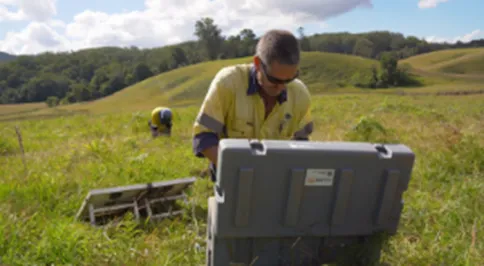
Installing AusLAMP sensors
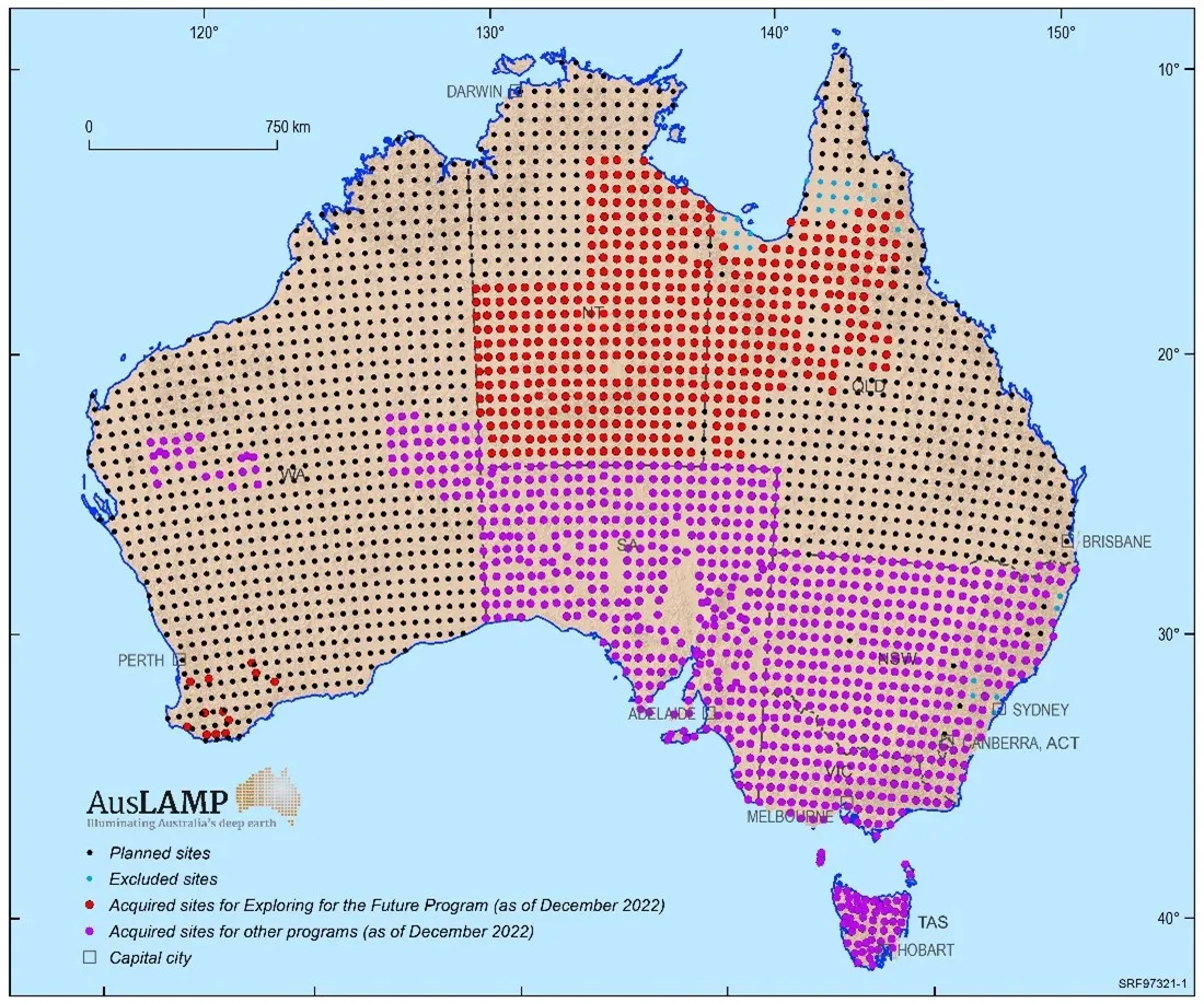
A current map showing the locations of the magnetotelluric stations across Australia
AusLAMP assists with:
* understanding the geological make up of Australia
* understanding how geological processes work
* mapping geological hazards, such as historic earthquakes
* analysing risks to Australia's electricity infrastructure
* helping to identify mineral and energy resource potential on a broad regional scale.
Under the Exploring for the Future program, data from ~550 sites were acquired across northern Australia, and 38 sites in Western Australia. These data augment AusLAMP data previously acquired across southern Australia under other collaborative projects, and have been used to generate electrical conductivity models of the deep crust and lithosphere covering ~50% of the continent.
All publicly released AusLAMP data/interpretation and models are available on the Geoscience Australia website and via the Exploring for the Future Data Delivery Portal. Read more about the AusLAMP project.
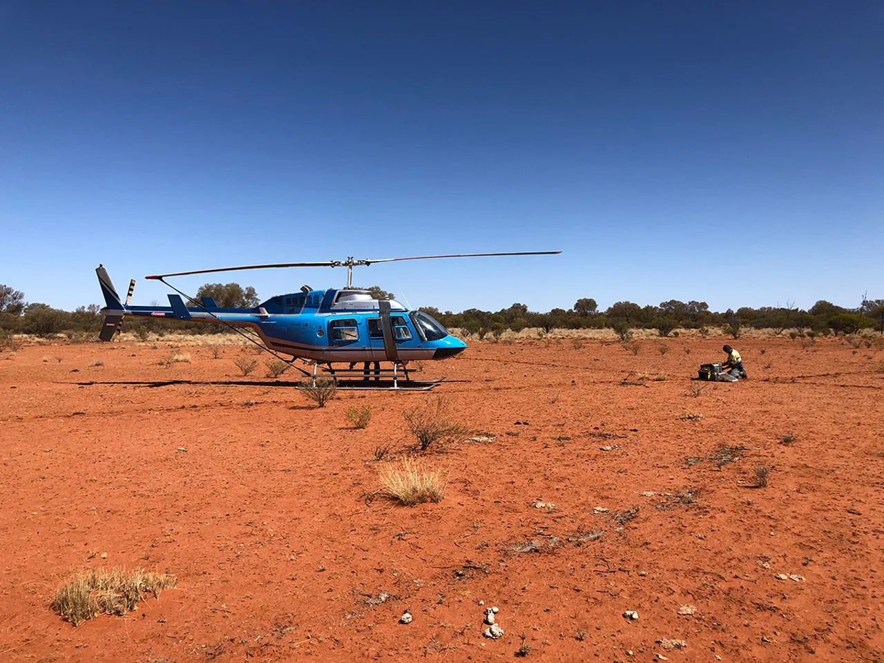
Magnetotelluric data collection equipment being deployed on site in the Northern Territory
The following AusLAMP data and publications were produced under the Exploring for the Future program. To see the full list of AusLAMP outputs, please visit the AusLAMPpage on the Geoscience Australia website.
AusLAMP is a collaboration between Geoscience Australia, the state and Northern Territory geological surveys, universities, AuScope and other research organisations.
Exploring for the Future AusLAMP activities were funded by Geoscience Australia with supplementary funding and in-kind contributions from the Geological Survey of Queensland and in-kind contributions from the Northern Territory Geological Survey and the Geological Survey of Western Australia.
Geoscience Australia acknowledges the landholders, communities and First Nations people who support our work in rural, regional, and remote Australia to produce AusLAMP datasets.

The Australian Passive Seismic Array Project (AusArray) is a collaborative, national survey between government and academia that acquires passive seismic data.

Approximately 80 % of the Australian landmass is blanketed post-mineralisation sedimentary cover and regolith. The cover presents a challenge to successful exploration.

The Geochronology and Isotopic Mapping component of the Exploring for the Future program provided key isotopic datasets in both tabulated compilations, and map form for visualisation with other geological datasets.


