Completed 2024 Australia’s Resources Framework
![Helicopter landing after day of field work, kicking up dust and debris](/_nuxt/image/33884c.jpg)
This project laid the foundations for a national view of Australia’s surface and sub-surface geology, underpinning our understanding of the continent’s mineral, energy and groundwater potential.
Through new, large-scale data acquisition, advances in big data analytics and tailored resource assessments, the outputs of this project support the resource sector, agriculture, remote communities and the environment, and contribute to community safety.
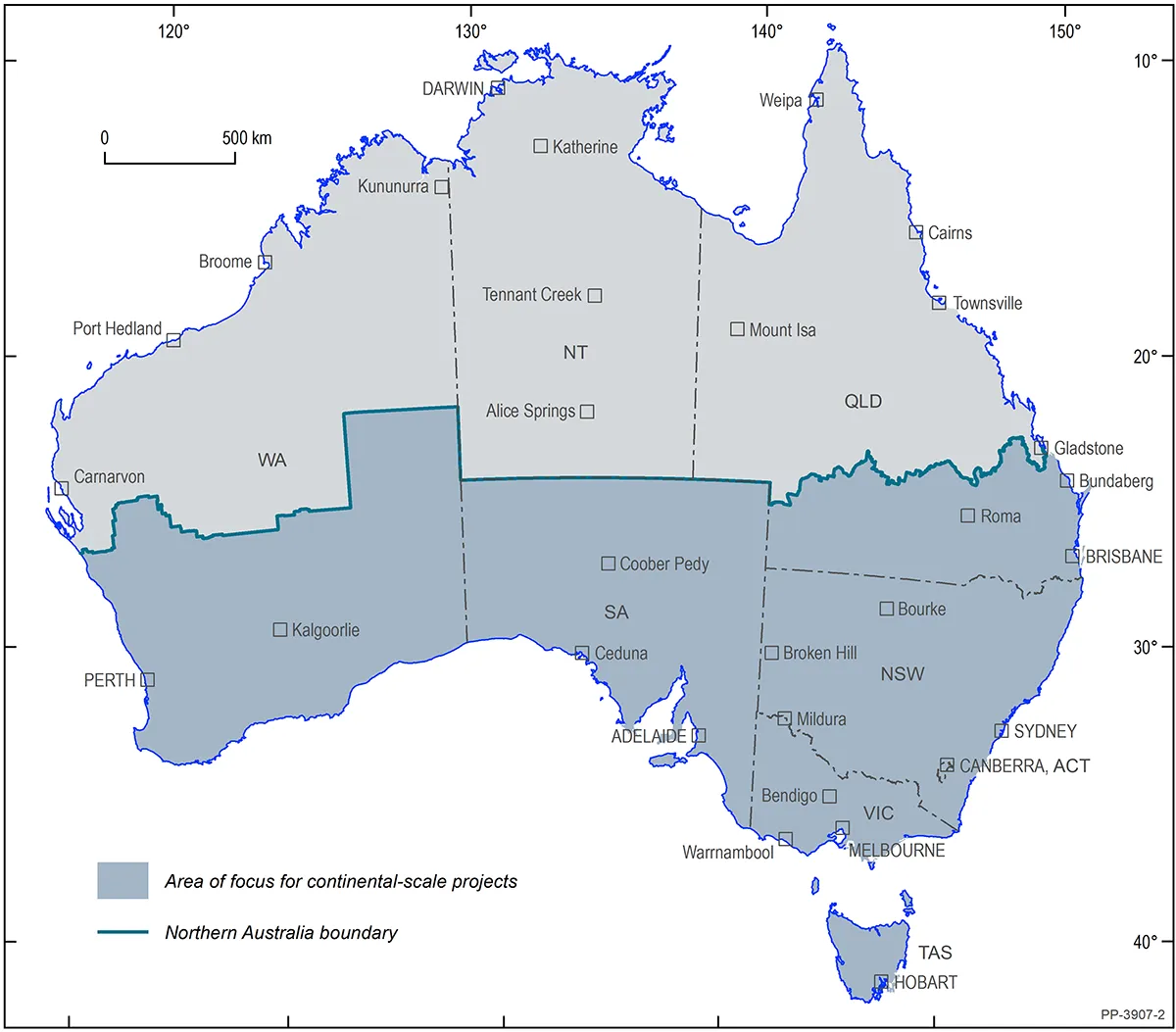
Key data acquisition activities included continued development of fundamental national datasets, such as AusAEM, AusArray, AusLAMP, geochemistry, mineralogy, geochronology and the Isotopic Atlas. Targeted data acquisition programs include deposit geochronology and geochemical analysis of mine waste for critical minerals.
Analysis of new and legacy datasets feed into interpretative products, such as seamless multi-layered sub-surface geology models, including variations in geochemical and geophysical properties, from the top few centimetres to hundreds of kilometres below the Earth’s surface. This evolving geological framework shines new light on processes that control mineral, energy and groundwater distribution and thereby resource potential across Australia.
What we did
The Australia’s Resources Framework project incorporated a number of study areas and activities grouped into 3 categories, including:
Geophysics
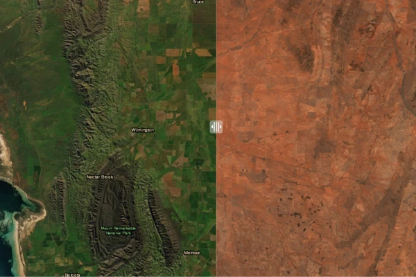
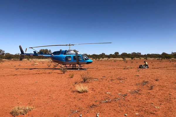
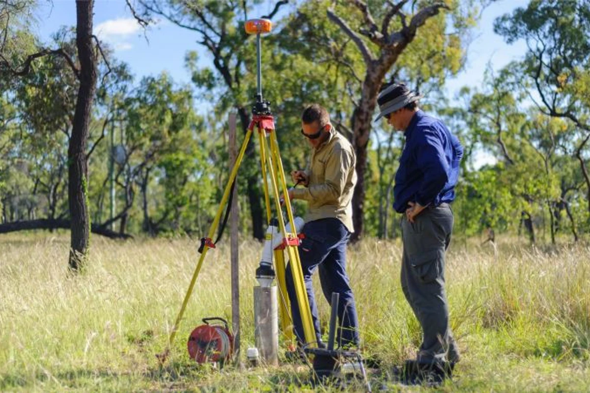
The AusAEM airborne electromagnetic (AEM) survey was one of the main components of the Exploring for the Future program. The program acquired 20 km line spaced AEM data across broad regions of the continent to improve the understanding of regional basin architecture and geology. Surveying was prioritised to areas relatively under-explored but with high mineral, energy or groundwater potential, where AEM can greatly assist in investigating the earth below cover rocks.
Visit the AusAEM page for more information.
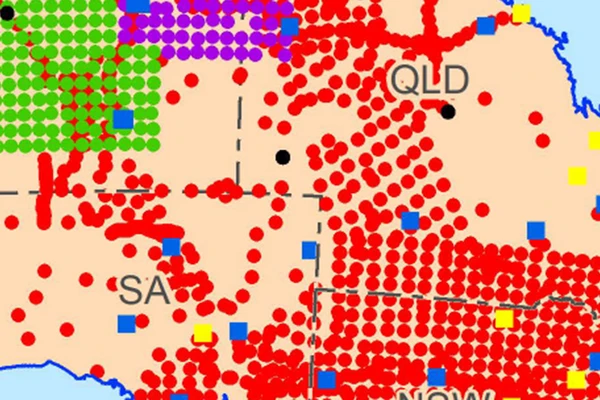
AusLAMP acquired magnetotelluric data at sites spaced every 50 km within and adjacent to the Eastern and Western Resources Corridors. The data was analysed to better understand the electrical properties of major structures in the lithosphere, such as domain boundaries, faults, shear zones and fluid pathways. This improves geophysical imaging of mineral system components and enhances understanding of related mineral potential. It also contributes to studies of space weather hazard in Australia that feed into assessments of related risks to critical infrastructure, such as telecommunications networks, power lines and pipelines.
Visit the AusLAMP page for more information.
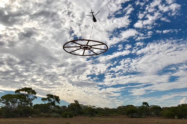
AusArray acquired passive seismic data to infer physical properties of the Australian lithosphere. Sensors were distributed across the continent at 200 km spacing to ensure full national coverage. Acquired data will be used in geophysical inversions to build thermomechanical Earth models that extend to depths of hundreds of kilometres. These high-fidelity models will facilitate mapping of alteration in the uppermost mantle as a key constraint on mineral prospectivity assessments. Results also inform geohazard studies. All data and tools developed during this project activity will be freely available to the public to help support an emerging resource exploration technology.
Visit the AusArraypage for more information.
This project activity integrated geophysical and geological data using geophysical techniques to link deep Earth processes to resource endowment. It developed the understanding of the relationship between the near surface and deep Earth architecture by mapping the structure and composition of the lithospheric mantle under the constraints provided from geochemical analysis of mantle xenoliths and xenocrysts.
This study included robust gravity and magnetic inversion modelling techniques used in conjunction with innovative, in-house processing to deliver seamless 3D density and magnetic susceptibility models that cover all onshore Australia. These models followed on from previous work done on the North Australian Craton and were designed to assist 3D geological mapping and the identification of large-scale mineral systems, such as those associated with iron oxide copper-gold deposits.
These 3D models utilised geological constraints from SEEBASE, AusMoho and the Curie depth with the potential for further model enhancements in the future when other national datasets become available.
Geoscience Australia and Mineral Resources Tasmania gathered high resolution airborne magnetic and radiometric data across parts of Tasmania. New data infilled areas where sparse and low-quality magnetic data was acquired during the 1960’s to 1980’s, at 1,500 m flight line spacing, and where no radiometric data existed. The flight line spacing was standardised to 200 m and used modern processing techniques to significantly improve the magnetic data quality and usability. The acquisition of new data made a major contribution to understanding the regional geology that controls Tasmanian mineral systems and provides insight into prospective geology under cover.
This project activity improved the outcomes from airborne electromagnetic (AEM) data acquisition by introducing probabilistic sub-surface assessment. Using High Performance computing (HPC) leads to improved visualization and decision-making under uncertainty with geophysical data. Theory and code developed in this project was also used to carry out real time Quality Control (QC) of AEM acquired for the Exploring for the Future program and other projects. For example, this capability was used for the 4,500 km line Great Artesian Basin 2021 AEM survey. There are links to the AEM acquisition and sub-surface conductivity imaging for the Officer–Musgrave project, as well as for the mineral and groundwater resource mapping components of the Darling–Curnamona–Delamerian project. Probabilistic sub-surface conductivity estimates also fed into the Cover Mapping component of the National Geological Mapping study. Finally, a 1D AEM + (audio) MT joint inversion capability adds value to AusLAMP, which in turn aids National Mineral Potential Mapping.
Geochemistry
The National Geochemical Framework study delivered a series of precompetitive surficial geochemistry datasets to contribute to mineral prospectivity assessments. It included 3 key activities (Levelled Geochemical Baselines, Surface Mineralogy and Isotopic Signatures and Geochemical Grids of Australia) that assist in characterising Australia’s surface composition in terms of chemistry, mineralogy and isotopic composition, and mapping processes such as weathering, dispersion and identifying indicators of mineral systems. Learn more about the National Geochemical Framework study.
This project activity collected age and isotopic data and maps, working towards comprehensive nationwide coverage. It included expansion of the geochronology dataset at the national scale, and enhancing existing holdings in Sm-Nd and Lu-Hf isotopic data. It also included collecting new analyses to develop a coverage of Pb-Pb isotopes in basement rocks across south-eastern Australia. This basement dataset adds context to the existing Pb-Pb in ores dataset and works towards developing the Pb-Pb system as an exploration tool in greenfields areas. We have also added new Sr and Pb -isotope data from regolith samples in collaboration with other Exploring for the Future program activities.
Geochemical data inventory of combined organic and inorganic geochemical data, leading to targeted sampling of key sedimentary basins important for present exploration across Australia (e.g. Stuart shelf, Officer Basin, greater McArthur Basin, Georgina basin). This allows the reinterpretation of datasets with the aim to test for the presence of key mineral and energy system components. This activity was undertaken in collaboration with the Australia’s Future Energy Resources and Officer-Musgrave projects.
This project activity created a new compilation of major Australian mineral deposits, including data on the age of key mineral deposits, particularly those containing critical minerals and those that are important to the regional Exploring for the Future projects and national mineral potential mapping. It provided a video animation illustrating the relationships between ore deposits and geological, tectonic and geophysical features and tectonometallogenic events. It also collected new ages from selected mineral deposits, including in north-western Tasmania.
This project activity aimed to support the sustainable and economic recovery of critical minerals from secondary sources through a national-scale assessment of mine waste to identify new opportunities for critical minerals supply. The assessment aimed to provide accurate geospatial and resource information about Australian mine waste. It included a sampling campaign, with initial focus on regional priority areas, to provide chemical and mineralogical data to quantify the resource potential of existing mine waste. The project contributed to Australia’s world-leading environmental, social and governance standards supporting the transition to net-zero carbon emissions.
This study reviewed the Mineral Occurrences and OzMin databases and all available mineral occurrence maps to provide up-to-date information to help plan other Exploring for the Future projects, starting with the regional projects ( Darling–Curnamona–Delamerian, Officer–Musgrave, Barkly–Isa–Georgetown), and validate mineral potential models. The maps and literature review were used as input into the Critical Mineral Mapping Initiative Mineral Deposit Classification system.
Integrated Geological Products
The National Geological Mapping project activity provided the foundations for a national scale view of Australia’s sub-surface geology to improve knowledge of mineral, energy and groundwater systems. It included the following key activities: the Alkaline Rocks Atlas of Australia, Cover Mapping, Layered Geology Mapping, Major Crustal Boundaries and LOOP 3D, which generated new knowledge and data infrastructure at a national scale broadly applicable to academia, industry, communities and government.
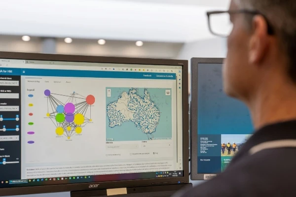
This study developed testable conceptual mineral system models underpinned by an understanding of the geological, geophysical and geochemical processes that must occur for the mineral system to form. It delivered national mineral potential assessments to support predictive mapping of selected mineral systems and associated critical minerals, including iron-oxide copper gold, sediment hosted base metals and alkaline rocks.
For more information about this work, including links to completed assessments, please visit the Mineral Potential Mapping page.
This project activity developed the national Economic Fairways Mapper tool to enable rapid, high-level economic assessment of the opportunities and challenges for the development of a range of commodities across Australia. During the Exploring for the Future program, the Economic Fairways Mapper tool was updated to include new base and precious metals—including copper, gold, lead, nickel, phosphate, potash, and zinc—as well as associated critical commodities, such as platinum-group elements and rare earth elements. Energy-related commodities were also added, with a particular focus on hydrogen and ammonia. Analysis was also undertaken into the integration of complex systems, such as green steelmaking, carbon capture and storage (CCS), and environmental, social and governance (ESG) mapping. The project activity also developed computational codes for the analysis of hydrocarbon and desalinated groundwater systems.
Visit the Economic Fairways page for more information.
Outputs
- 2022. P5020 East Tasmania Magnetic and Radiometric Survey, 2022. Geoscience Australia, Canberra
- 2021. P5003 Tasmanian Tiers Airborne Magnetic, Radiometric and Elevation Dataset: point-located data, grids and report (Tasmania, 2021). Geoscience Australia, Canberra
- Ball, P. W., Czarnota, K., White, N. J., Klöcking, M., Davies, D. R. Thermal Structure of Eastern Australia's Upper Mantle and its Relationship to Cenozoic Volcanic Activity and Dynamic Topography. AGU Journal. 2021. Volume 22, Issue 8
- Bryant, C., Beyer, E., Buddee, M., Champion, D., Highet, L., Brown, C., Bonnardot, M., Ford, A. 2023. Alkaline Rocks Atlas. Supporting assessment of critical mineral potential in Australia. Geoscience Australia, Canberra
- Bryant, C., Champion, D., Highet, L. 2023. Paleozoic alkaline and related igneous rocks of Australia. GA Record 2023/034. Geoscience Australia, Canberra
- Bryant, C., Highet, L. 2023. Paleozoic alkaline and related igneous rocks of Australia GIS. Geoscience Australia, Canberra
- Bryant, C., Buddee, M., Champion, D.C., Beyer, E., Highet, L. 2023. Proterozoic alkaline and related igneous rocks of Australia. GA Record 2023/48. Geoscience Australia, Canberra
- Buddee, M., Bryant, C., Highet, L., Champion, D.C., Beyer, E. 2023. Proterozoic alkaline and related igneous rocks of Australia GIS. Geoscience Australia, Canberra
- Buddee, M., Champion, D., Highet, L. 2023. Cenozoic alkaline and related igneous rocks of Australia. Record 2023/06. Geoscience Australia, Canberra
- Buddee, M., Champion, D., Highet, L. 2023. Cenozoic alkaline and related igneous rocks of Australia GIS. Geoscience Australia, Canberra
- Champion, D.C., Highet, L., Buddee, M. 2022. Mesozoic Alkaline and related igneous rocks of Australia. Record: 2022/038. Geoscience Australia, Canberra
- Champion, D., Highet, L., Buddee, M. 2022. Mesozoic Alkaline and related igneous rocks of Australia GIS. Geoscience Australia, Canberra
- Champion, D.C., Highet, L., Thorne, J.P. 2022. Archean alkaline and related igneous rocks of Australia. Record 2022/036. Geoscience Australia, Canberra
- 2022. Archean alkaline and related igneous rocks of Australia GIS. Geoscience Australia, Canberra
- Cloutier, J., Ford, A., Huston, D., Doublier, M., Schofield, A., Waltenberg, K., de Caritat, P., Fraser, G., Beyer, E., Bastrakov, E., Czarnota, K. 2023. National mineral potential assessment for sediment-hosted copper mineral systems in Australia Version 1.0. Geoscience Australia, Canberra
- Cloutier, J., Ford, A., Huston, D., Doublier, M., Schofield, A., Waltenberg, K., de Caritat, P., Fraser, G., Beyer, E., Bastrakov, E., Czarnota, K. 2023. Sediment-hosted base metal mineral potential maps. Geoscience Australia, Canberra
- Cloutier, J., Ford, A., Huston, D., Doublier, M., Schofield, A., Waltenberg, K., de Caritat, P., Fraser, G., Beyer, E., Bastrakov, E., Czarnota, K. 2023. National mineral potential for sediment-hosted zinc-lead mineral systems in Australia Version 1.0. Geoscience Australia, Canberra
- Cloutier, J., Ford, A., Huston, D., Doublier, M., Schofield, A., Waltenberg, K., de Caritat, P., Fraser, G., Beyer, E., Bastrakov, E., Czarnota, K. 2023. Sediment-hosted base metal mineral potential maps. Geoscience Australia, Canberra
- Connors, K.A., Wong, S., Vilhena, J.F.M., Rees, S., Feitz, A. 2022. Canning Basin AusAEM interpretation: hydrogen storage potential and multilayered mapping. Geoscience Australia, Canberra
- de Caritat, P., Walker, A.T., Bastrakov, E., Main, P., McInnes, B.I.A. 2023. The Heavy Mineral Map of Australia Project. Final Data Release. National Dataset and Atlas. GA Record 2023/42. Geoscience Australia, Canberra
- de Caritat, P., Walker, A.T., Bastrakov, E., McInnes, B.I.A. 2023. The Heavy Mineral Map of Australia: vision, implementation and progress. Geoscience Australia, Canberra
- de Caritat, P., Dosseto, A., and Dux, F. A strontium isoscape of northern Australia. Earth System Science Data, 15, 1655–1673. 2023
- de Caritat, P., Dosseto, A., Dux, F. 2022. A strontium isoscape of inland southeastern Australia. Geoscience Australia, Canberra
- Desem, C. U., de Caritat, P., Woodhead, J., Maas, R., and Carr, G. A regolith lead isoscape of Australia. Earth Syst. Sci. Data, 16, 1383–1393. 2024
- Duan, J., Kyi, D., Hitchman, A., Jiang, W. 2023. Resistivity structures derived from AusLAMP magnetotellurics data in Queensland. Geoscience Australia, Canberra
- Duan, J. 2021. Electrical resistivity structures and mineral prospectivity from Exploring for the Future AusLAMP data (2016-2019) in northern Australia. Record 2021/021. Geoscience Australia, Canberra
- Ford, A., Huston, D., Cloutier, J., Doublier, M., Schofield, A., Cheng, Y., Beyer, E. 2023. Carbonatite-related rare earth element mineral potential maps. Geoscience Australia, Canberra
- Ford, A., Huston, D., Cloutier, J., Doublier, M., Schofield, A., Cheng, Y., Beyer, E. A national-scale mineral potential assessment for carbonatite-related rare earth element mineral systems in Australia. Ore Geology Reviews, Volume 161, 2023
- Foss, C. A., Hope, J., Patabendigerada, S. 2024. Regional magnetic depth estimates for Eastern Resources Corridor (ERC), Officer Basin, Tasmania and Northeast Queensland. Geoscience Australia, Canberra
- Goodwin, J. 2023. Airborne Magnetic and Radiometric Technical Standards - Data Acquisition, Processing and Supply. Record 2023/04. Geoscience Australia, Canberra
- Guan, Q., Mei, Y., Etschmann, B., Louvel, M., Testemale, D., Bastrakov, E., Brugger, J. Yttrium speciation in sulfate-rich hydrothermal ore-forming fluids. Geochimica et Cosmochimica Acta. Volume 325. 2022. Pp 278-295
- Haynes, M., Morfiadakis, A., Pincus, J. 2024. Inferred lithospheric mantle metasomatism. Geoscience Australia, Canberra
- Haynes, M., Wang, C., Walsh, S.D.C., Weng, Z., Feitz, A. 2024. The Green Steel Economic Fairways Mapper. Geoscience Australia Extended Abstract, Canberra
- Hejrani, B. 2023. Ambient noise tomography of Australia: Application to AusArray deployment - Update. Geoscience Australia, Canberra
- Holzschuh, J. 2023. AusArray TROMINO® active seismic data acquisition, processing and MASW modelling. Geoscience Australia record
- Holzschuh, J., Gorbatov, A., Glowacki, J., Cooper, A., Cooper, C. 2022. AusArray temporary passive seismic station deployment, servicing and retrieval: Geoscience Australia standard operating procedures. Geoscience Australia, Canberra
- Holzschuh, J., Gorbatov, A., Glowacki, J., Cooper, A., Cooper, C. 2022. AusArray temporary passive seismic station deployment, servicing and retrieval: Geoscience Australia standard operating procedures. GA record: 2022/026. Geoscience Australia, Canberra
- Hope, J., Wong, S., Foss, C. A., Buddee, M., Sanchez, G., Bonnardot, M. 2024. Regional magnetic depth estimates for Eastern Resources Corridor (ERC), Officer Basin, Tasmania and Northeast Queensland - Interpretation Data Package.
Geoscience Australia, Canberra - Huston, D.L., Champion, D.C., Czarnota, K., Duan, J., Hutchens, M., Paradis, S., Hoggard, M., Ware, B., Gibson, G.M., Doublier, M.P., Kelley, K., McCafferty, A., Hayward, N., Richards, F., Tessalina, S., Carr, G. Zinc on the edge—isotopic and geophysical evidence that cratonic edges control world-class shale-hosted zinc-lead deposits. 2022. Mineralium Deposita, 58, 707-729
- Huston, D., Doublier, M., Eglington, B., Pehrsson, S., Mercier-Langevin, P., Piercey, S. 2022. Convergent margin metallogenic cycling in the Eastern Goldfields Superterrane and Tasman Element. Geoscience Australia, Canberra
- Huston, D., Eglington, B., Pehrsson, S., Piercey, S. 2022. Global database of zinc-lead-bearing mineral deposits. Record 2022/010. Geoscience Australia, Canberra
- Huston, D., Norman, M.D., Maas, R., Miggins, D., Thiede, D.S., Vasconcelos, P., Creaser, R.A., Cross, A.J., Bennett, V., Bottrill, R.S., Lisitsin, V., Duncan, R., Forster, D., Brauhart, C., Dhnaram, C., Champion, D.C., Czarnota, K., Whitaker, A. 2022. Geochronological studies of selected Australian mineral deposits, 2003 – 2020. Record 2022/011. Geoscience Australia, Canberra
- Huston, D., Doublier, M., Downes, P.M. 2021. Geological setting, age and endowment of major Australian mineral deposits - a compilation. Geoscience Australia, Canberra
- Jones, S. L., Waltenberg, K., Ramesh, R., Cumming, G., Everard, J.L., Vicary, M.J., Bodorkos, S., Bottrill, R.S., Knight, K., McNeill, A.W., Meffre, S. 2022. Isotopic Atlas of Australia: Geochronology compilation for Tasmania. Version 1.0. Record 2022/44. Geoscience Australia, Canberra
- Kennett, B.L.N., Gorbatov, A., Yuan, H., Agrawal, S., Murdie, R., Doublier, M.P., Eakin, C.M., Miller, M.S., Zhao, L., Czarnota, K., O’Donnell, J.P., Dentith, M., Gessner, K. Refining the Moho across the Australian continent. Geophysical Journal International. Volume 233, Issue 3, June 2023, Pages 1863–1877
- Kirkby, A., Czarnota, K., Huston, D.L., Champion, D.C., Doublier, M.P., Bedrosian, P.A., Duan, J., Heinson, G. Lithospheric conductors reveal source regions of convergent margin mineral systems. 2022. Scientific Reports 12, 8190
- Kirkby, A., Doublier, M. Synthetic magnetotelluric modelling of a regional fault network – implications for survey design and interpretation. 2022. Exploration Geophysics
- Kucka, C., Senior, A., Britt, A. 2022. Mineral Occurrences: Forgotten discoveries providing new leads for mineral supply. Geoscience Australia, Canberra
- Lambert, I.B. 2023. Potential impacts of opportunities arising from Australia's green energy transition with emphasis on critical minerals and mining wastes. Geoscience Australia, Canberra
- Lawley, C.J.M., McCafferty, A.E., Graham, G.E., Huston, D.L., Kelley, K.D., Czarnota, K., Paradis, S., Peter, J.M., Hayward, N., Barlow, M., Emsbo, P., Coyan, J., Carma, J.C., San Juan, C.A., Gadd, M.G. Data–driven prospectivity modelling of sediment–hosted Zn–Pb mineral systems and their critical raw materials. Ore Geology Reviews. 2022. Volume 141
- Ley Cooper, Y. 2021. Exploring for the Future AusAEM Eastern Resources Corridor: 2021 Airborne Electromagnetic Survey TEMPEST® airborne electromagnetic data and GALEI inversion conductivity estimates. Geoscience Australia, Canberra
- Main, P., Champion, D., Byass, J., Gilmore, S. 2023. Legacy stream sediment sample reanalysis - Red River, Hann River, Ebagoola, Coen, Georgetown, Kakadu, Araluen, Brindabella, Hedleys Creek, and Mammoth Mines Surveys. Record 2023/013. Geoscience Australia, Canberra
- Main, P. 2023. Geochemical Levelling Code. Geoscience Australia, Canberra
- Main, P.T., Champion, D.C. Levelling of multi-generational and spatially isolated geochemical surveys. Science Direct Journal. 2022. Volume 240
- Magee, C.W. Jr., Bodorkos, S., Lewis, C.J., Crowley, J.L., Wall, C.J., Friedman, R.M. Examination of the accuracy of SHRIMP U–Pb geochronology based on samples dated by both SHRIMP and CA-TIMS. Geochronology. Volume 5, Issue, 1, January 2023
- Manassero, M.C., Özaydın, S., Afonso, J.C., Shea, J.J., Ezad, I.S., Kirkby, A., Thiel, S., Fomin, I., Czarnota, K. Lithospheric structure and melting processes in southeast Australia: New constraints from joint probabilistic inversions of 3D magnetotelluric and seismic data. Journal of Geophysical Research: Solid Earth, Volume 129, Issue 3, 2 March 2024
- Ng, W., Minasny, B., McBratney, A., de Caritat, P., Wilford, J. 2023. Digital soil mapping of lithium in Australia. Record Vol 15, issue 6. Geoscience Australia, Canberra
- Ray, A., Ley-Cooper, Y., Brodie, R., Taylor, R., Symington, N., Moghaddam, N. An information theoretic Bayesian uncertainty analysis of AEM systems over Menindee Lake, Australia. Geophysical Journal International, Volume 235, Issue 2, November 2023, Pages 1888–1911
- Ray, A. Bayesian inversion using nested trans-dimensional Gaussian processes. Geophysical Journal International. 2021. Volume 226, Issue 1
- Ray, A., Taylor, R., Symington, N., Brodie, R., LeyCooper, Y., Moghaddam, N. 2023. The High Quality Geophysical Analysis software package: HiQGA.jl. Geoscience Australia, Canberra
- Sudholz, Z.J., Yaxley, G.M., Jaques, A.L., Cooper, S.A., Czarnota, K., Taylor, W.R., Chen, J., Knowles, B.M. Multi-Stage Evolution of the South Australian Craton: Petrological Constraints on the Architecture, Lithology, and Geochemistry of the Lithospheric Mantle. Geochemistry, Geophysics, Geosystems. November 2022. Volume 23, Issue 11
- Sudholz, Z., Reddicliffe, T., Jaques, A., Yaxley, G., Haynes, M., Gorbatov, A., Czarnota, K., Frigo, C., Maas, R., Knowles, B. Petrology, Age, and Rift Origin of Ultramafic Lamprophyres (Aillikites) at Mount Webb, a New Alkaline Province in Central Australia. Geochemistry, Geophysics, Geosystems. Volume 24, Issue 10. 2023.
- Thorne, J., Sexton, M., Hawkins, S., Weng, Z., Kucka, C., Sedgmen, A., Morfiadakis, A. 2023. Australian Mine Waste Database. Geoscience Australia, Canberra
- Vilhena, J.F.M., Connors, K.A., Wong, S.C.T., Nicoll, M.G. 2023. Canning Basin AusAEM Airborne Electromagnetic Interpretation Data Package. Geoscience Australia, Canberra
- Wilford, J., LeyCooper, Y., Sudipta Basak. 2023. National surface and near-surface conductivity grids. Geoscience Australia, Canberra
- Wilford, J., LeyCooper, Y., Basak, S., Czarnota, K. 2022. High resolution conductivity mapping using regional AEM survey and machine learning. Geoscience Australia, Canberra
- Wilford, J. 2022. High resolution conductivity mapping using regional AEM survey and machine learning. Dataset. Geoscience Australia, Canberra
- Wilford, J., Roberts, D. 2021. Sentinel-2 Barest Earth mosaic. Geoscience Australia, Canberra
- Wilford, J., Roberts, D. 2021. Sentinel-2 Barest Earth imagery for soil and lithological mapping. Geoscience Australia, Canberra. Exploring for the Future extended abstract
- Waltenberg, K., Jones, S.L., Duncan, R.J., Waugh, S., Lane, J. 2021. Isotopic Atlas of Australia: Geochronology compilation for Victoria. Version 1.0. Record 2021/024. Geoscience Australia, Canberra
- Waltenberg, K., Curtis, C., Lem, A., Bodorkos, S. 2021. Isotopic Atlas of Australia: Lu Hf and O isotope data structure and delivery. Version 1.0: North Australian Craton compilation. Record 2021/016. Geoscience Australia, Canberra
- Wilford, J., de Caritat, P., Basak, S. 2023. Predictive grids of major oxide concentrations in surface rock and regolith over the Australian continent. Geoscience Australia, Canberra
- Wong, S.C.T., Hegarty, R.A., Pitt, L., Crowe, M.C., Roach, I., Nicoll, M., LeyCooper, Y., Hope, J., Bonnardot, M. 2023. Eastern Resources Corridor Airborne Electromagnetic Interpretation Data Package. Geoscience Australia, Canberra
- Zametzer, A., Kirkland, C., Hartnady, M., Barham, M., Champion, D., Bodorkos, S., Smithies, H., Johnson, S. Applications of Pb isotopes in granite K-feldspar and Pb evolution in the Yilgarn Craton. Geochimica et Cosmochimica Acta. Volume 320. 2022. Pp 279-303.
Collaboration
Geoscience Australia acknowledges all landholders and communities who support our work in rural, regional and remote Australia.
- AuScope
- Department of Industry, Science and Resources
- Geological Survey of South Australia
- Geological Survey of New South Wales
- Geological Survey of Victoria
- Geological Survey of Western Australia
- Mineral Resources Tasmania
- Northern Territory Geological Survey
- NSW Department of Planning, Industry and Environment
- MinEx CRC
- RMIT University
Related information
![Heavy Mineral Map of Australia (HMMA) Release Workshop - 12 October 2023](/_nuxt/image/d63073.png)
Heavy Mineral Map of Australia Release Workshop
The Heavy Mineral Map of Australia (HMMA) is the world’s first public domain, continental-scale heavy mineral dataset and atlas. Through a collaboration with Curtin University, over 1,000 archived samples from across Australia have been analysed for automated identification and quantification of heavy minerals. The HMMA and accompanying cloud-based mineral network analysis (MNA) tool will positively impact mineral exploration and prospectivity modelling around Australia, as well as have other applications in earth and environmental sciences. The HMMA and MNA tool was publicly released at a workshop on 12 October 2023 in Perth.
![A person looking at the computer screen](/_nuxt/image/6743bc.jpg)
Mapping Australia’s heavy minerals in world-first
The Australian Government’s Exploring for the Future program is continuing to deliver for the resources industry with the release of a new tool to support the discovery of minerals critical to the net zero transformation. The Heavy Mineral Map of Australia, developed by Geoscience Australia in collaboration with Curtin University, has been created using heavy mineral samples found in floodplain sediments from across the country.
![The Victorian coverage of geochronology and isotopes](/_nuxt/image/3f262a.png)
Collaboration building Geoscience Australia’s Isotopic Atlas of Australia
Ongoing collaboration between Geoscience Australia and a wide range of agencies and institutions is building a nationally valuable database of geochronology and isotopes.
![A snapshot of regular satellite imagery on the left and Sentinel-2 Barest Earth imagery on the right](/_nuxt/image/2383e9.png)
Sentinel-2 reveals the barest Earth
Researchers from Geoscience Australia and the Australian National University have recently released a new national Barest Earth product that uses the Digital Earth Australia satellite archive.
![AusArray](/_nuxt/image/3b6a49.jpg)
AusArray
The Australian Passive Seismic Array Project (AusArray) is a collaborative, national survey between government and academia that acquires passive seismic data.
![AusAEM](/_nuxt/image/cc9542.jpg)
AusAEM
AusAEM is the world’s largest airborne electromagnetic (AEM) survey undertaken. AusAEM started in 2017 in northern Australia and continues to be extended across the continent.
![Magnetotelluric data collection equipment being deployed on site in the Northern Territory.](/_nuxt/image/1356e6.jpg)
AusLAMP
The Australian Lithospheric Architecture Magnetotelluric Project (AusLAMP) is a collaborative, national survey that acquires long-period magnetotelluric (MT) data across Australian continental.
![Geoscience Australia staff engaging with communities](/_nuxt/image/14e06d.jpeg)
Important community information
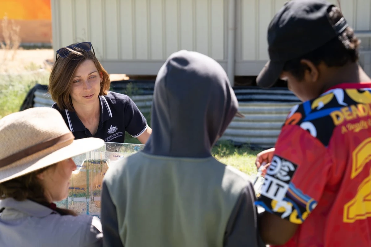
Geoscience Australia is committed to land, air and marine access best practice and to protecting cultural heritage and the environment.
We thank the people and communities who collaborate with us to ensure the success of the Exploring for the Future program.
Geoscience Australia activities are not undertaken on behalf of any exploration company; we work for the benefit of all Australians.
All data produced by Geoscience Australia, including the data from this project, is publicly available after quality assurance has been performed.
For more information or general enquiries, please email clientservices@ga.gov.au
![Groundwater](/_nuxt/image/aa79f7.jpg)
Program 2020-24
The Exploring for the Future program (2020–24) focused on 8 interrelated projects, united in growing our understanding of Australia's geology.
Deep-dive
Three deep-dive projects in potentially resource-rich corridors identified in the east and west of Australia: Darling–Curnamona–Delamerian, Officer–Musgrave–Birrindudu and Barkly–Isa–Georgetown projects.
National
Three national projects with a focus on southern Australia: Australia’s Resources Framework, National Groundwater Systems and Australia’s Future Energy Resources projects.
Program support
Two program support projects: Enhanced Data Delivery and Geoscience Knowledge Sharing projects.